
Image Resource Bank
Image Gallery |  1 of 15
Map of the Contemporary Middle East
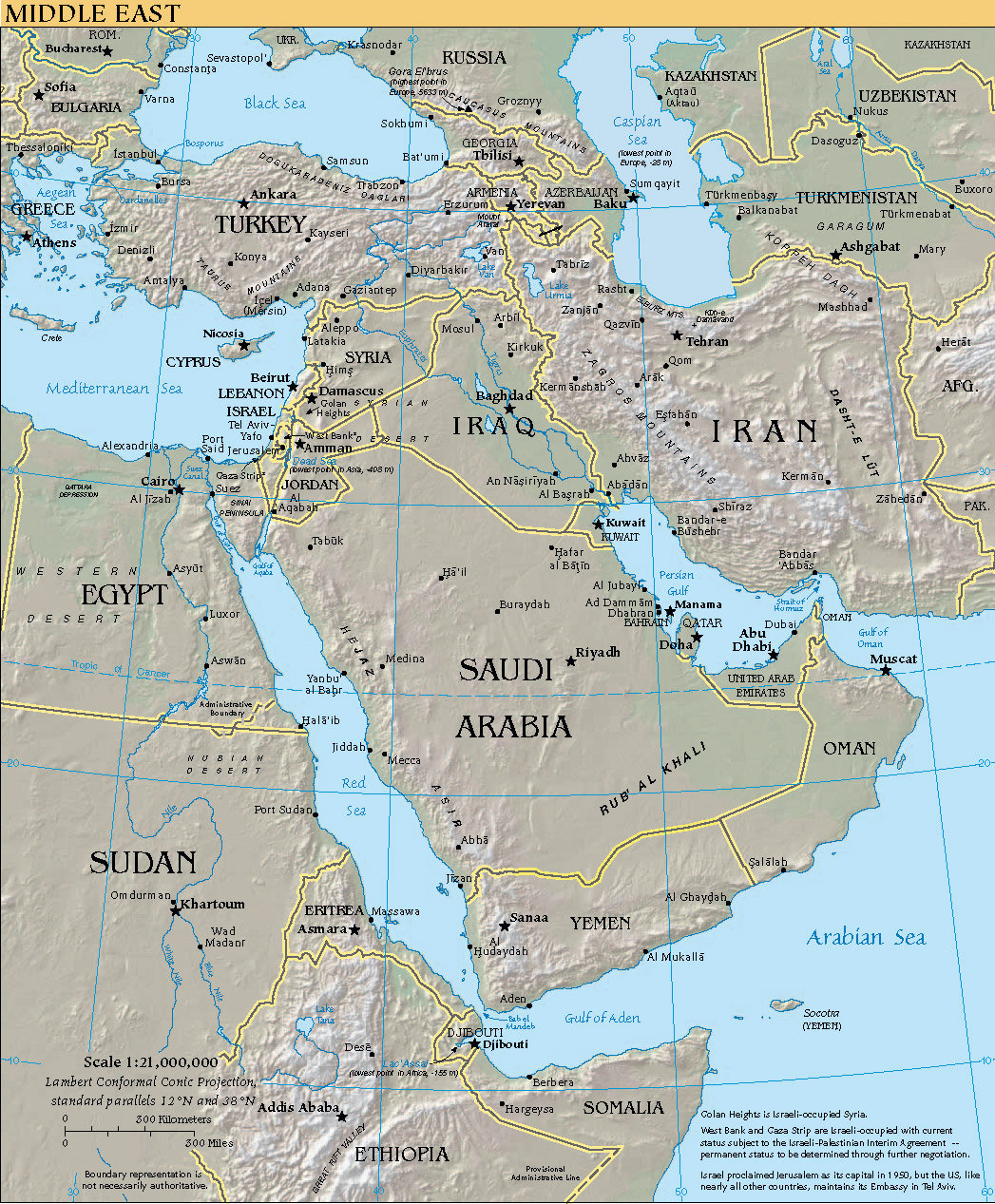
A map of the Middle East created by the CIA for its online World Factbook resource: capital cities are designated with a star, nation-state borders are outlined in yellow, and some physical features have been added to show the Middle East’s varied topography. It is interesting to note that the distance from Iran’s eastern border with Pakistan to Egypt’s western border with Libya is roughly the same as the distance from Washington, D.C., to Los Angeles, CA. The distance from Istanbul in the north to the southern tip of the Arabian Peninsula is greater than the distance from the U.S.-Mexico border to the U.S.-Canada border. The Middle East is home to a complex assortment of ethnicities and races. Within this diverse cultural milieu, dozens of languages are spoken, and people come from many different religious backgrounds, including Judaism, Christianity, Islam, Zoroastrianism, and the Baha’i faith.
Name: Middle East
Material: Digital Image
Size: 11005 x 1184 pixels
Date: January 8, 2009
Place of Origin: Central Intelligence Agency World Factbook
Location: Wikimedia
Source and Registration#: Wikimedia Commons. Link to resource![]() (accessed June 24, 2010).
(accessed June 24, 2010).

 John Woods
Professor of Iranian and Central Asian History and of Near Eastern Languages and Civilizations, The University of Chicago
 Alexander Barna
Outreach Coordinator, Center for Middle Eastern Studies, University of Chicago