
Image Resource Bank
Image Gallery |  11 of 15
Cairos, quae olim Babylon Aegypti maxima vrbs
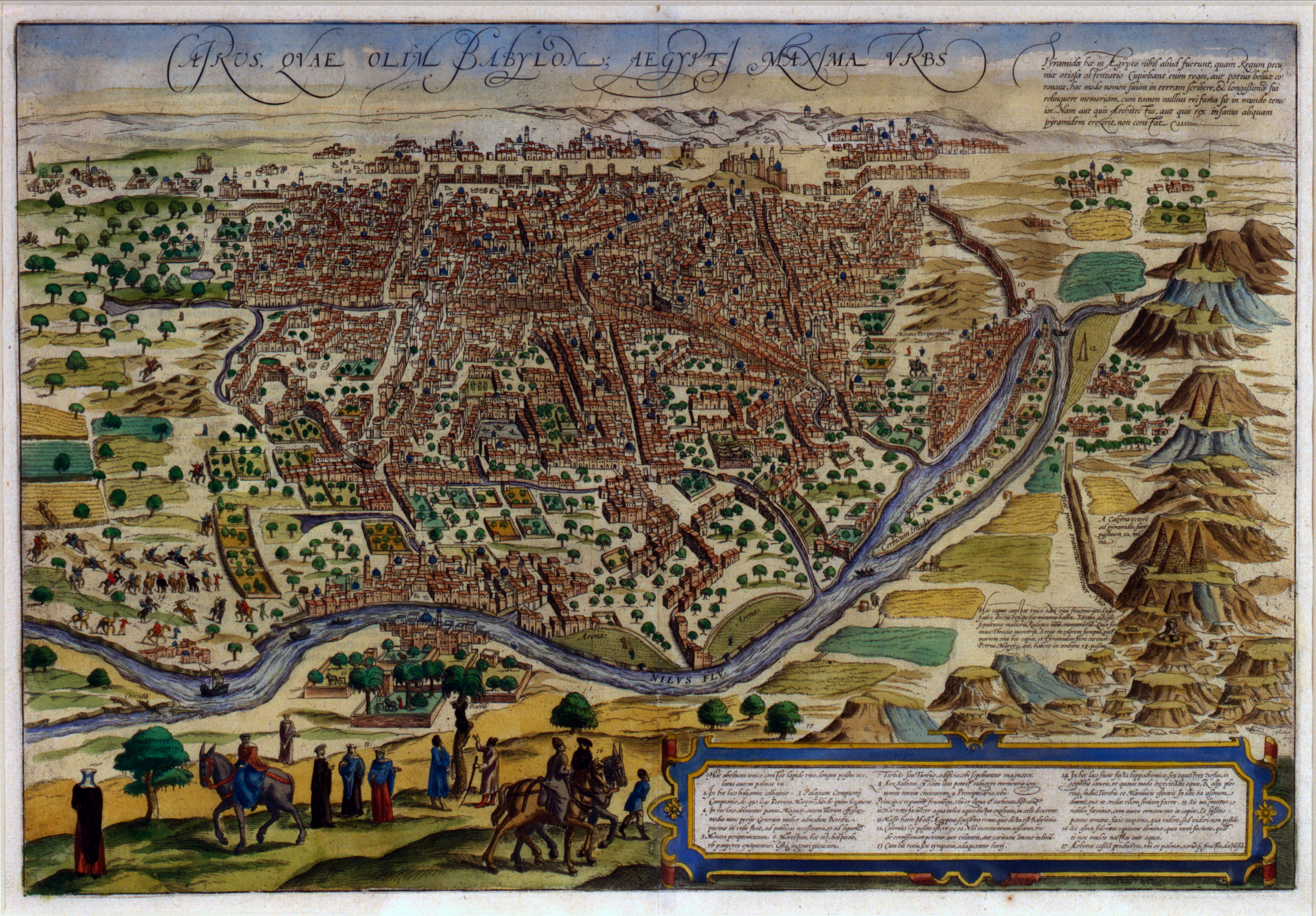
In the fifteenth and sixteenth centuries CE, Europeans began to explore and document the rest of the world as they never had before. While rediscovering long-dormant connections with the Middle East, South Asia, and the Far East, they also found whole continents that were unknown to them in the Americas and later in Australia and Antarctica. The engines of exploration were both economic and intellectual, both a need for long-distance trade in materials and products that were found on some continents and not others, and a conceptual framework in which natural history and natural sciences were inseparable from human history and human society.
Geography was destiny. This outlook is reflected in maps of the kind illustrated here, where the layout of the streets of Cairo is rendered in three dimensions and also embedded in representations of vegetation, costume, transport, and topography. Other maps might include allegorical figures—winds, fantastic wildlife, stylized racial portrayals—that look silly or reprehensible to modern viewers. Contemporary viewers might have seen them as useful combinations of data, abstraction, and interpretation.
Name: Cairos, quae olim Babylon Aegypti maxima vrbs
Material: Engraving, hand-colored
Size:
Height: 33 cm (13 in)
Width: 48.5 cm (19 in)
Date: 1575 CE
Place of Origin: Civitates Orbis Terrarum, Cologne; Georg Braun and Frans Hogenberg
Location: O.J. Sopranos Collection
Source and Registration#: O.J. Sopranos Collection, OJS.02 Map LI-442.21

 Matthew W. Stolper
Professor of Assyriology and the John A. Wilson Professor of Oriental Studies