
Image Resource Bank
Image Gallery |  12 of 15
Satellite Image of Iraq and Iran
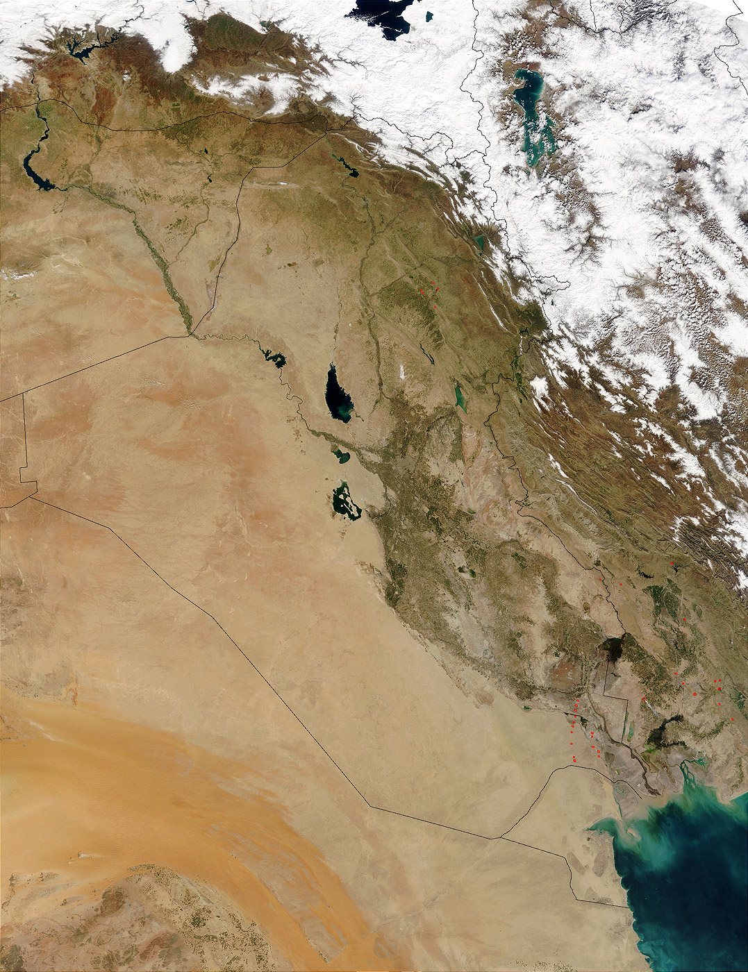
This National Aeronautics and Space Administration (NASA) satellite image is called a Moderate Resolution Imaging Spectroradiometer (MODIS). It shows numerous oil-well flares (the burning off of combustible gases associated with oil) in southern Iraq (center) as well as physical characteristics of the land. Included in this photograph are the countries of Saudi Arabia, Iraq, Kuwait, and Iran.
Name: Iraq_A2003060_0750_500m.jpg
Material: Digital photograph
Size: 2,000 × 2,600 pixels, file size: 1,012 KB
Place of Origin: National Aeronautics and Space Administration (NASA) Satellite
Date: March 1, 2003
Location: NASA
Source and Registration#:
Wikimedia Commons![]()
(accessed April 29, 2010)

 Geoff Emberling
Former Chief Curator, Oriental Institute Museum of the University of Chicago