
Image Resource Bank
Image Gallery |  1 of 15
Map of the Middle East
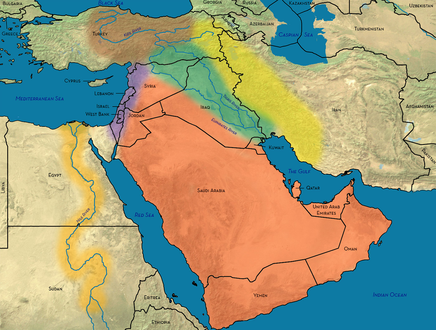
Map of the Middle East showing major geographic zones and modern political boundaries.
From west to east:
Nile River (orange)
Eastern Mediterranean (purple)
Anatolian Plateau (brown)
Arabian Peninsula (red)
Mesopotamia (green)
Zagros Mountains (yellow)
Name: Map of the Middle East
Material: Digital Image
Size:
Width: 25 cm (9.84 in)
Length: 14.6 cm (5.75 in)
Place of Origin: The Oriental Institute Museum
Date: 2008
Location: Oriental Institute Museum, Chicago, Illinois
Source and Registration#: Middle East Base.tif, Oriental Institute Museum.

 Geoff Emberling
Former Chief Curator, Oriental Institute Museum of the University of Chicago