 Print Page
Classroom Connections
Lesson Plans & Guiding Questions
LESSON 1
Political and Geographic Dimensions of an Empire of the Ancient Middle East
Students will examine some of the maps and artifacts of the empires of the ancient Middle East in an effort to characterize them and compare and contrast them to modern states.
Created By: Howard Wright, Hinsdale South High School, Hinsdale, IL
Subject Area(s): World History, World Geography, maybe even Comparative Government.
For Grade Level(s): 9–10
LESSON 2
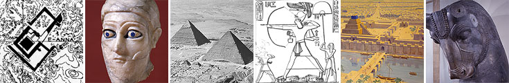
Art—as an Expression of Empire
As an extension of their study of the empires of the ancient Middle East, students will examine some images from the Module to determine what they convey about the nature of empire and the capacity to express important cultural values.
Created By: Howard Wright, Hinsdale South High School, Hinsdale, IL
Subject Area(s): World History, World Geography, Art Appreciation
For Grade Level(s): 9–12
Time Needed: Two class periods